We inventory a selection of Backroad Mapbooks.
Please visit the Backroad Mapbooks website here and then contact us for Inventory.
Backroad Mapbooks Logo Southern Ontario Topographic and Eastern Ontario Depth Chart.
Backroad Mapbooks Mission Statement:
To provide the recreational enthusiast with the most up-to-date and detailed maps and information available in the outdoor market.
Mussio Ventures Ltd. was incorporated in 1993 and has become one of the top three map producers and one of the biggest publishers in Canada. We are in the business of producing, publishing, distributing and marketing Outdoor Recreation guidebooks and topographic maps. Selling over 100,000 copies annually of our Backroad Mapbook series is easily the best selling Outdoor Recreation guidebook series in Canada. We also sell almost 50,000 copies of our various Fishing Mapbooks, GPS Maps, Outdoor Recreation Maps, Topographic Maps and Digital Maps across Canada annually.
Russell and Wesley Mussio started the Backroad Mapbook Series in 1993. The brothers are avid backcountry explorers who love to pursue a variety of different activities. They came up with the idea when they realized it was rather cumbersome to cart a different book for each activity along with a stack of often-outdated maps.
Over the years, we have seen their small business grow to include up to a dozen people at any given time working on various publications across the country. Most of the production work is done out of our office/warehouse in Coquitlam, BC, but we also have affiliate offices near Ottawa, Ontario and outside of Kelowna, BC. To ensure a local touch, we contract writers/researchers from across the country.
The success of the company can be attributed to the unique type of product we offer. The emphasis on maps has allowed us to carve out a niche in the very competitive outdoor recreation guidebook market. Our books offer a unique combination of detailed topographic maps covering specific areas of a province along with descriptions on everything from fishing holes to hidden trails to places to camp and canoe.
Although the books get a lot of positive feedback, we are always looking for ways to improve them. It is through listening to our consumers, retailers and knowledgeable people that we are able to constantly improve the guidebooks. In fact, we encourage any comments or updates on any of the products. This constant search to make the best product available to the consumer at a reasonable price has been a successful formula for the company.
Our goal is to produce the most complete and up to date recreation guidebooks and maps in Canada. We are also actively looking to advance our digital side of the business including making our products e-book, Google Earth, smart phone and GPS compatible. By expanding this side of the business, we are confident we will have a product that will be sought after by all generations. Our ultimate goal is to have the Backroad Mapbook Series be considered ‘The Guidebook Series’ for exploring the Great Outdoors throughout North America. Whether you want a printed mapbook or a map you can load onto your iPhone or GPS, we want to be the product that shows you the way.
Backroad Mapbooks
The Backroad Mapbook Series is Canada’s guide to the outdoors. We pride ourselves on providing up-to-date topographic maps and outdoor recreation descriptions needed to get you outdoors safely and confidently. We have Backroad maps for all of Canada in a variety of formats including our very popular mapbooks, PDF books, digital maps, GPS maps and TOPO maps.
Here are a few features that make our mapbooks such a hit:
Backroad Mapbook Highlights:
- Complete area topographic map coverage at better scales (150,000–250,000 depending on the province and region);
- Extensive logging, industry and bush road coverage detailing road systems not found on most other maps;
- Labeled backcountry roads and recreational features;
- Trail systems, including defined ATV, snowmobile & multi-use trails;
- Paddling routes with access points and portages marked;
- Parks, protected and natural areas clearly labeled with symbols showcasing the main activities or amenities;
- Recreation sites, conservation areas and regional park systems labeled and symboled;
- Wildlife Management Unit boundaries for anglers and hunters;
- Elevation relief shading with labeled contours to highlight mountains and river valleys;
- UTM Grids along with latitude and longitude bearings;
- Ontario Crown and Private/Restricted Land identified;
- Alberta and Manitoba township grids.
Descriptions or write-ups on Backroad Attractions, Fishing (lakes, streams & ocean), Hunting, Paddling (lake, river & ocean), Parks and Recreation Sites, Trails (hiking, biking, ATV & multi-use), Wildlife Viewing, Winter Recreation (cross-country ski, downhill ski, snowshoe & snowmobile)
And much, much more.
BC mapbooks feature up to date forest service roads and trail systems along with unique British Columbia features like BC recreation sites, natural hot springs, big trees and ocean based activities. BC Backroad map areas include Vancouver Island, Cariboo Chilcotin, Kootenay Rockies, Northern BC, Thompson Okanagan and Vancouver Coast.
Alberta and the Prairie mapbooks showcase up to date oil & gas roads and trail systems along with unique features like Off Highway Vehicle areas, Alberta recreation areas and those famed national parks. Alberta Backroad Mapbook areas include Canadian Rockies, Central Alberta, Northern Alberta and Southern Alberta. Further east we have Southern Saskatchewan and all of Manitoba backroad maps.
Ontario and eastern Canada mapbooks highlight Ontario forest roads and trail systems along with unique features like snowmobile routes, Ontario Conservation Areas and Maritime beaches. Ontario Backroad Mapbooks include Cottage Country Ontario, Eastern Ontario, Northeastern Ontario, Northwestern Ontario and Southwestern Ontario. In Quebec we have Southwestern Quebec and the Montreal Laurentians. We also cover all of Nova Scotia, New Brunswick and PEI with Backroad maps.
The Backroad Mapbooks come in Print & PDF book versions.
 https://thefirstcast.ca/wp-content/uploads/2021/01/Georgian-Bay-Driftwood-Art-F.jpg
1536
2048
admin
https://thefirstcast.ca/wp-content/uploads/2013/12/TFC-Header_Web_2B.jpg
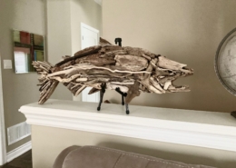
admin2021-01-31 15:20:122021-01-31 17:53:20Georgian Bay Driftwood Art
https://thefirstcast.ca/wp-content/uploads/2021/01/Georgian-Bay-Driftwood-Art-F.jpg
1536
2048
admin
https://thefirstcast.ca/wp-content/uploads/2013/12/TFC-Header_Web_2B.jpg
admin2021-01-31 15:20:122021-01-31 17:53:20Georgian Bay Driftwood Art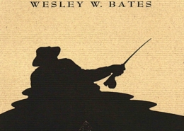 https://thefirstcast.ca/wp-content/uploads/2020/12/Casting-into-Mystery-casting_cover_high_res-AA-scaled.jpg
2560
1627
admin
https://thefirstcast.ca/wp-content/uploads/2013/12/TFC-Header_Web_2B.jpg
admin2020-12-08 23:14:312020-12-08 23:22:04Casting into Mystery – Robert Reid – Engravings By Wesley W. Bates
https://thefirstcast.ca/wp-content/uploads/2020/12/Casting-into-Mystery-casting_cover_high_res-AA-scaled.jpg
2560
1627
admin
https://thefirstcast.ca/wp-content/uploads/2013/12/TFC-Header_Web_2B.jpg
admin2020-12-08 23:14:312020-12-08 23:22:04Casting into Mystery – Robert Reid – Engravings By Wesley W. Bates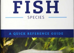 https://thefirstcast.ca/wp-content/uploads/2020/01/INVASIVE-FISH-SPECIES-01112020-STAA.jpg
2450
1553
admin
https://thefirstcast.ca/wp-content/uploads/2013/12/TFC-Header_Web_2B.jpg
admin2020-01-18 14:06:052020-01-18 14:06:59Invasive Fish Species – A Quick Reference Guide
https://thefirstcast.ca/wp-content/uploads/2020/01/INVASIVE-FISH-SPECIES-01112020-STAA.jpg
2450
1553
admin
https://thefirstcast.ca/wp-content/uploads/2013/12/TFC-Header_Web_2B.jpg
admin2020-01-18 14:06:052020-01-18 14:06:59Invasive Fish Species – A Quick Reference Guide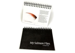 https://thefirstcast.ca/wp-content/uploads/2019/11/My-Salmon-Flies-by-Mikael-Frödin-Books_Films_3-2_1024x.jpg
644
860
admin
https://thefirstcast.ca/wp-content/uploads/2013/12/TFC-Header_Web_2B.jpg
admin2019-11-16 21:10:372022-01-04 23:22:32“My Salmon Flies” by Mikael Frödin
https://thefirstcast.ca/wp-content/uploads/2019/11/My-Salmon-Flies-by-Mikael-Frödin-Books_Films_3-2_1024x.jpg
644
860
admin
https://thefirstcast.ca/wp-content/uploads/2013/12/TFC-Header_Web_2B.jpg
admin2019-11-16 21:10:372022-01-04 23:22:32“My Salmon Flies” by Mikael Frödin https://thefirstcast.ca/wp-content/uploads/2017/11/Swing-The-Fly-Magazine-C.png
129
390
admin
https://thefirstcast.ca/wp-content/uploads/2013/12/TFC-Header_Web_2B.jpg
admin2017-11-29 20:58:022018-09-10 19:37:38Swing The Fly Magazine
https://thefirstcast.ca/wp-content/uploads/2017/11/Swing-The-Fly-Magazine-C.png
129
390
admin
https://thefirstcast.ca/wp-content/uploads/2013/12/TFC-Header_Web_2B.jpg
admin2017-11-29 20:58:022018-09-10 19:37:38Swing The Fly Magazine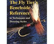 https://thefirstcast.ca/wp-content/uploads/2017/03/The-Fly-Tiers-Benchside-Reference-to-Techniques-and-Dressing-Styles-Ted-Lesson-Jim-Schollmeyer.jpg
225
225
admin
https://thefirstcast.ca/wp-content/uploads/2013/12/TFC-Header_Web_2B.jpg
admin2017-03-26 19:00:542017-03-26 19:00:54The Fly Tier’s Benchside Reference to Techniques and Dressing Styles – Ted Lesson & Jim Schollmeyer
https://thefirstcast.ca/wp-content/uploads/2017/03/The-Fly-Tiers-Benchside-Reference-to-Techniques-and-Dressing-Styles-Ted-Lesson-Jim-Schollmeyer.jpg
225
225
admin
https://thefirstcast.ca/wp-content/uploads/2013/12/TFC-Header_Web_2B.jpg
admin2017-03-26 19:00:542017-03-26 19:00:54The Fly Tier’s Benchside Reference to Techniques and Dressing Styles – Ted Lesson & Jim Schollmeyer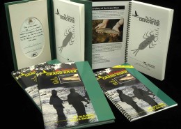 https://thefirstcast.ca/wp-content/uploads/2015/01/Limited-Editions-Signed-Fly-Fishing-The-Grand-River-Ian-D-Martin-and-Jane-E-Rutherford-Hard-Cover-and-Soft-Cover-BB.jpg
1761
2198
Ray
https://thefirstcast.ca/wp-content/uploads/2013/12/TFC-Header_Web_2B.jpg
Ray2015-01-27 20:32:472016-07-20 23:36:20Limited Edition – Numbered & Signed – Fly Fishing The Grand River – Dr. Ian D. Martin & Jane E. Rutherford – Hard & Soft Cover Copies
https://thefirstcast.ca/wp-content/uploads/2015/01/Limited-Editions-Signed-Fly-Fishing-The-Grand-River-Ian-D-Martin-and-Jane-E-Rutherford-Hard-Cover-and-Soft-Cover-BB.jpg
1761
2198
Ray
https://thefirstcast.ca/wp-content/uploads/2013/12/TFC-Header_Web_2B.jpg
Ray2015-01-27 20:32:472016-07-20 23:36:20Limited Edition – Numbered & Signed – Fly Fishing The Grand River – Dr. Ian D. Martin & Jane E. Rutherford – Hard & Soft Cover Copies https://thefirstcast.ca/wp-content/uploads/2014/10/BIO-Picture-resized.jpg
380
500
Ray
https://thefirstcast.ca/wp-content/uploads/2013/12/TFC-Header_Web_2B.jpg
Ray2014-10-14 21:25:592019-07-17 20:33:04Artwork by Al Hassall
https://thefirstcast.ca/wp-content/uploads/2014/10/BIO-Picture-resized.jpg
380
500
Ray
https://thefirstcast.ca/wp-content/uploads/2013/12/TFC-Header_Web_2B.jpg
Ray2014-10-14 21:25:592019-07-17 20:33:04Artwork by Al Hassall https://thefirstcast.ca/wp-content/uploads/2014/11/Al-Hassall-Buck-Bugs-Steelhead-007.jpg
480
640
admin
https://thefirstcast.ca/wp-content/uploads/2013/12/TFC-Header_Web_2B.jpg
admin2014-11-18 15:27:372014-11-18 15:27:37Al Hassall’s – “Buck Bug Steelhead”
https://thefirstcast.ca/wp-content/uploads/2014/11/Al-Hassall-Buck-Bugs-Steelhead-007.jpg
480
640
admin
https://thefirstcast.ca/wp-content/uploads/2013/12/TFC-Header_Web_2B.jpg
admin2014-11-18 15:27:372014-11-18 15:27:37Al Hassall’s – “Buck Bug Steelhead” https://thefirstcast.ca/wp-content/uploads/2014/11/Al-Hassall-Bulkley-River-Buck1.jpg
480
640
admin
https://thefirstcast.ca/wp-content/uploads/2013/12/TFC-Header_Web_2B.jpg
admin2014-11-18 15:09:042014-11-18 15:14:43Al Hassall’s – “Bulkley River Buck”
https://thefirstcast.ca/wp-content/uploads/2014/11/Al-Hassall-Bulkley-River-Buck1.jpg
480
640
admin
https://thefirstcast.ca/wp-content/uploads/2013/12/TFC-Header_Web_2B.jpg
admin2014-11-18 15:09:042014-11-18 15:14:43Al Hassall’s – “Bulkley River Buck”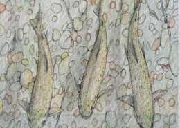 https://thefirstcast.ca/wp-content/uploads/2014/10/Al-Hassall-3-Amigos.jpg
388
418
admin
https://thefirstcast.ca/wp-content/uploads/2013/12/TFC-Header_Web_2B.jpg
admin2014-10-29 22:40:302014-10-29 23:09:22Al Hassall’s – “3 Amigos”
https://thefirstcast.ca/wp-content/uploads/2014/10/Al-Hassall-3-Amigos.jpg
388
418
admin
https://thefirstcast.ca/wp-content/uploads/2013/12/TFC-Header_Web_2B.jpg
admin2014-10-29 22:40:302014-10-29 23:09:22Al Hassall’s – “3 Amigos”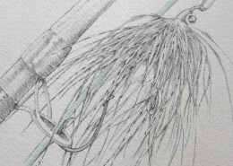 https://thefirstcast.ca/wp-content/uploads/2014/10/Al-Hassall-Blue-Line.jpg
560
458
admin
https://thefirstcast.ca/wp-content/uploads/2013/12/TFC-Header_Web_2B.jpg
admin2014-10-29 22:16:492014-10-29 23:10:21Al Hassall’s – “Blue Line”
https://thefirstcast.ca/wp-content/uploads/2014/10/Al-Hassall-Blue-Line.jpg
560
458
admin
https://thefirstcast.ca/wp-content/uploads/2013/12/TFC-Header_Web_2B.jpg
admin2014-10-29 22:16:492014-10-29 23:10:21Al Hassall’s – “Blue Line” https://thefirstcast.ca/wp-content/uploads/2014/10/Al-Hassall-Yin-Yang-Disco-Ball.jpg
410
600
admin
https://thefirstcast.ca/wp-content/uploads/2013/12/TFC-Header_Web_2B.jpg
admin2014-10-29 22:01:082014-10-29 23:17:14Al Hassall’s – “Yin Yang Disco Ball”
https://thefirstcast.ca/wp-content/uploads/2014/10/Al-Hassall-Yin-Yang-Disco-Ball.jpg
410
600
admin
https://thefirstcast.ca/wp-content/uploads/2013/12/TFC-Header_Web_2B.jpg
admin2014-10-29 22:01:082014-10-29 23:17:14Al Hassall’s – “Yin Yang Disco Ball”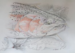 https://thefirstcast.ca/wp-content/uploads/2014/10/Al-Hassall-RED-Cheeks-Black-Tube.jpg
480
640
Ray
https://thefirstcast.ca/wp-content/uploads/2013/12/TFC-Header_Web_2B.jpg
Ray2014-10-21 17:32:272014-10-31 13:14:04Al Hassall’s – “Red Cheeks, Black Tube”
https://thefirstcast.ca/wp-content/uploads/2014/10/Al-Hassall-RED-Cheeks-Black-Tube.jpg
480
640
Ray
https://thefirstcast.ca/wp-content/uploads/2013/12/TFC-Header_Web_2B.jpg
Ray2014-10-21 17:32:272014-10-31 13:14:04Al Hassall’s – “Red Cheeks, Black Tube”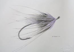 https://thefirstcast.ca/wp-content/uploads/2014/10/Additional-Art-for-First-Cast-006.jpg
480
640
Ray
https://thefirstcast.ca/wp-content/uploads/2013/12/TFC-Header_Web_2B.jpg
Ray2014-10-21 17:22:452014-10-29 23:12:58Al Hassall’s – “Kola Fly” ( Rick Whorwood Tie )
https://thefirstcast.ca/wp-content/uploads/2014/10/Additional-Art-for-First-Cast-006.jpg
480
640
Ray
https://thefirstcast.ca/wp-content/uploads/2013/12/TFC-Header_Web_2B.jpg
Ray2014-10-21 17:22:452014-10-29 23:12:58Al Hassall’s – “Kola Fly” ( Rick Whorwood Tie ) https://thefirstcast.ca/wp-content/uploads/2014/10/Al-Hassall-Kola-Fly-o-OakcINKS-and-Seasonable-Anglers-for-Publication-2014-001.jpg
480
640
Ray
https://thefirstcast.ca/wp-content/uploads/2013/12/TFC-Header_Web_2B.jpg
Ray2014-10-14 21:45:002014-10-29 23:14:18Al Hassall’s – “Kola Fly on Oak”
https://thefirstcast.ca/wp-content/uploads/2014/10/Al-Hassall-Kola-Fly-o-OakcINKS-and-Seasonable-Anglers-for-Publication-2014-001.jpg
480
640
Ray
https://thefirstcast.ca/wp-content/uploads/2013/12/TFC-Header_Web_2B.jpg
Ray2014-10-14 21:45:002014-10-29 23:14:18Al Hassall’s – “Kola Fly on Oak” https://thefirstcast.ca/wp-content/uploads/2014/10/Al-Hassall-Brookie-on-Wood-INKS-and-Seasonable-Anglers-for-Publication-2014-002.jpg
480
640
Ray
https://thefirstcast.ca/wp-content/uploads/2013/12/TFC-Header_Web_2B.jpg
Ray2014-10-14 21:36:492014-10-29 23:16:24Al Hassall’s – “Brooky on Wood”
https://thefirstcast.ca/wp-content/uploads/2014/10/Al-Hassall-Brookie-on-Wood-INKS-and-Seasonable-Anglers-for-Publication-2014-002.jpg
480
640
Ray
https://thefirstcast.ca/wp-content/uploads/2013/12/TFC-Header_Web_2B.jpg
Ray2014-10-14 21:36:492014-10-29 23:16:24Al Hassall’s – “Brooky on Wood” https://thefirstcast.ca/wp-content/uploads/2016/11/Just-Fishing-JFSunsetBanner.png
61
350
admin
https://thefirstcast.ca/wp-content/uploads/2013/12/TFC-Header_Web_2B.jpg
admin2016-11-28 21:21:132016-11-28 21:31:42Just Fishing Magazine – FREE!
https://thefirstcast.ca/wp-content/uploads/2016/11/Just-Fishing-JFSunsetBanner.png
61
350
admin
https://thefirstcast.ca/wp-content/uploads/2013/12/TFC-Header_Web_2B.jpg
admin2016-11-28 21:21:132016-11-28 21:31:42Just Fishing Magazine – FREE!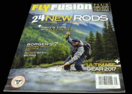 https://thefirstcast.ca/wp-content/uploads/2017/02/Fly-Fusion-Magazine-AA.jpg
1651
2198
admin
https://thefirstcast.ca/wp-content/uploads/2013/12/TFC-Header_Web_2B.jpg
admin2017-02-05 21:04:412018-05-13 21:35:29Fly Fusion Magazine
https://thefirstcast.ca/wp-content/uploads/2017/02/Fly-Fusion-Magazine-AA.jpg
1651
2198
admin
https://thefirstcast.ca/wp-content/uploads/2013/12/TFC-Header_Web_2B.jpg
admin2017-02-05 21:04:412018-05-13 21:35:29Fly Fusion Magazine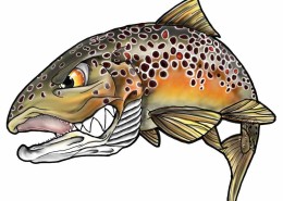 https://thefirstcast.ca/wp-content/uploads/2016/03/Fins-in-Frames-Brown-Trout-Sticker-AA.jpg
822
1030
admin
https://thefirstcast.ca/wp-content/uploads/2013/12/TFC-Header_Web_2B.jpg
admin2016-03-15 11:15:392017-02-26 20:14:03Fins In Frames – Artist Brandon Trafananko
https://thefirstcast.ca/wp-content/uploads/2016/03/Fins-in-Frames-Brown-Trout-Sticker-AA.jpg
822
1030
admin
https://thefirstcast.ca/wp-content/uploads/2013/12/TFC-Header_Web_2B.jpg
admin2016-03-15 11:15:392017-02-26 20:14:03Fins In Frames – Artist Brandon Trafananko https://thefirstcast.ca/wp-content/uploads/2015/02/Backroad-Mapbooks.png
179
281
admin
https://thefirstcast.ca/wp-content/uploads/2013/12/TFC-Header_Web_2B.jpg
admin2015-02-20 13:43:522017-01-16 17:19:52Backroad Mapbooks – Topographic Depth Charts, Maps & Guide
https://thefirstcast.ca/wp-content/uploads/2015/02/Backroad-Mapbooks.png
179
281
admin
https://thefirstcast.ca/wp-content/uploads/2013/12/TFC-Header_Web_2B.jpg
admin2015-02-20 13:43:522017-01-16 17:19:52Backroad Mapbooks – Topographic Depth Charts, Maps & Guide https://thefirstcast.ca/wp-content/uploads/2014/03/Online-Sales-Image.jpg
166
303
Ray
https://thefirstcast.ca/wp-content/uploads/2013/12/TFC-Header_Web_2B.jpg
Ray2014-03-02 13:45:372019-04-01 19:32:53Online Sales
https://thefirstcast.ca/wp-content/uploads/2014/03/Online-Sales-Image.jpg
166
303
Ray
https://thefirstcast.ca/wp-content/uploads/2013/12/TFC-Header_Web_2B.jpg
Ray2014-03-02 13:45:372019-04-01 19:32:53Online Sales https://thefirstcast.ca/wp-content/uploads/2014/02/Sale-Button-e1392429154585.jpg
120
120
Ray
https://thefirstcast.ca/wp-content/uploads/2013/12/TFC-Header_Web_2B.jpg
Ray2014-03-02 22:21:232017-02-12 18:25:20Clearance and Sale Items
https://thefirstcast.ca/wp-content/uploads/2014/02/Sale-Button-e1392429154585.jpg
120
120
Ray
https://thefirstcast.ca/wp-content/uploads/2013/12/TFC-Header_Web_2B.jpg
Ray2014-03-02 22:21:232017-02-12 18:25:20Clearance and Sale Items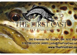 https://thefirstcast.ca/wp-content/uploads/2014/02/Gift-Card-Button-Brown-Trou-Head-e1392437742341.jpg
120
187
Ray
https://thefirstcast.ca/wp-content/uploads/2013/12/TFC-Header_Web_2B.jpg
Ray2014-02-14 23:20:332017-02-20 16:45:47Gift Cards are available in ANY Denomination
https://thefirstcast.ca/wp-content/uploads/2014/02/Gift-Card-Button-Brown-Trou-Head-e1392437742341.jpg
120
187
Ray
https://thefirstcast.ca/wp-content/uploads/2013/12/TFC-Header_Web_2B.jpg
Ray2014-02-14 23:20:332017-02-20 16:45:47Gift Cards are available in ANY Denomination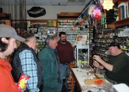 https://thefirstcast.ca/wp-content/uploads/2014/02/Joe-Penich-Altantic-Salmon-Wetfly-Session-030114-Resized-for-Web-e1393785098533.jpg
120
160
Ray
https://thefirstcast.ca/wp-content/uploads/2013/12/TFC-Header_Web_2B.jpg
Ray2014-02-17 19:43:022017-01-04 12:44:10Weekly Guest Tyer and Presenter Events – Sat. Noon to 3.
https://thefirstcast.ca/wp-content/uploads/2014/02/Joe-Penich-Altantic-Salmon-Wetfly-Session-030114-Resized-for-Web-e1393785098533.jpg
120
160
Ray
https://thefirstcast.ca/wp-content/uploads/2013/12/TFC-Header_Web_2B.jpg
Ray2014-02-17 19:43:022017-01-04 12:44:10Weekly Guest Tyer and Presenter Events – Sat. Noon to 3. https://thefirstcast.ca/wp-content/uploads/2014/01/Broken-St-e1392174268976.jpg
120
120
Ray
https://thefirstcast.ca/wp-content/uploads/2013/12/TFC-Header_Web_2B.jpg
Ray2014-02-11 22:02:342019-02-09 22:42:23Warranty Repairs & Service
https://thefirstcast.ca/wp-content/uploads/2014/01/Broken-St-e1392174268976.jpg
120
120
Ray
https://thefirstcast.ca/wp-content/uploads/2013/12/TFC-Header_Web_2B.jpg
Ray2014-02-11 22:02:342019-02-09 22:42:23Warranty Repairs & Service https://thefirstcast.ca/wp-content/uploads/2014/07/Wedding-Boutonniere-Bombanieri-Resized-e1404351818683.jpg
89
120
Ray
https://thefirstcast.ca/wp-content/uploads/2013/12/TFC-Header_Web_2B.jpg
Ray2014-07-02 21:25:062020-08-01 20:51:05Wedding Boutonnieres
https://thefirstcast.ca/wp-content/uploads/2014/07/Wedding-Boutonniere-Bombanieri-Resized-e1404351818683.jpg
89
120
Ray
https://thefirstcast.ca/wp-content/uploads/2013/12/TFC-Header_Web_2B.jpg
Ray2014-07-02 21:25:062020-08-01 20:51:05Wedding Boutonnieres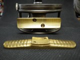 https://thefirstcast.ca/wp-content/uploads/2013/12/hardy_seat-e1390187906796.jpg
120
160
admin
https://thefirstcast.ca/wp-content/uploads/2013/12/TFC-Header_Web_2B.jpg
admin2013-12-30 23:59:212022-11-29 15:53:34Fly Reel Repairs and Customization – Have a Fly Reel sitting idle due to a river mishap?
https://thefirstcast.ca/wp-content/uploads/2013/12/hardy_seat-e1390187906796.jpg
120
160
admin
https://thefirstcast.ca/wp-content/uploads/2013/12/TFC-Header_Web_2B.jpg
admin2013-12-30 23:59:212022-11-29 15:53:34Fly Reel Repairs and Customization – Have a Fly Reel sitting idle due to a river mishap? https://thefirstcast.ca/wp-content/uploads/2017/02/Custom-Rod-Building-HLS-Mike-Rumig-02132016-AA.jpg
1458
1387
admin
https://thefirstcast.ca/wp-content/uploads/2013/12/TFC-Header_Web_2B.jpg
admin2017-02-12 18:14:222017-02-12 18:14:22Custom Rod Building
https://thefirstcast.ca/wp-content/uploads/2017/02/Custom-Rod-Building-HLS-Mike-Rumig-02132016-AA.jpg
1458
1387
admin
https://thefirstcast.ca/wp-content/uploads/2013/12/TFC-Header_Web_2B.jpg
admin2017-02-12 18:14:222017-02-12 18:14:22Custom Rod Building https://thefirstcast.ca/wp-content/uploads/2017/03/Simms-customshop.png
506
1000
admin
https://thefirstcast.ca/wp-content/uploads/2013/12/TFC-Header_Web_2B.jpg
admin2017-03-12 18:13:052019-04-24 19:16:16Simms Custom Breathable Wader Options
https://thefirstcast.ca/wp-content/uploads/2017/03/Simms-customshop.png
506
1000
admin
https://thefirstcast.ca/wp-content/uploads/2013/12/TFC-Header_Web_2B.jpg
admin2017-03-12 18:13:052019-04-24 19:16:16Simms Custom Breathable Wader Options https://thefirstcast.ca/wp-content/uploads/2014/01/Custom-Built-Bamboo-Rods-e1389654009722.png
120
239
admin
https://thefirstcast.ca/wp-content/uploads/2013/12/TFC-Header_Web_2B.jpg
admin2018-08-06 21:58:362020-04-28 21:24:35Split Cane or Bamboo Fishing Rod Repairs
https://thefirstcast.ca/wp-content/uploads/2014/01/Custom-Built-Bamboo-Rods-e1389654009722.png
120
239
admin
https://thefirstcast.ca/wp-content/uploads/2013/12/TFC-Header_Web_2B.jpg
admin2018-08-06 21:58:362020-04-28 21:24:35Split Cane or Bamboo Fishing Rod Repairs https://thefirstcast.ca/wp-content/uploads/2014/03/Berkley-Cyclone-Line-Winder-Edit-e1393793846894.jpg
120
161
Ray
https://thefirstcast.ca/wp-content/uploads/2013/12/TFC-Header_Web_2B.jpg
Ray2014-03-02 15:59:012017-02-20 16:54:14Professional Spooling / Winding – Fly Line & Backing / Dacron
https://thefirstcast.ca/wp-content/uploads/2014/03/Berkley-Cyclone-Line-Winder-Edit-e1393793846894.jpg
120
161
Ray
https://thefirstcast.ca/wp-content/uploads/2013/12/TFC-Header_Web_2B.jpg
Ray2014-03-02 15:59:012017-02-20 16:54:14Professional Spooling / Winding – Fly Line & Backing / Dacron https://thefirstcast.ca/wp-content/uploads/2017/02/1930s-Pre-War-JW-Young-and-Sons-Model-10B-4-inch-A-and-N-Stores-Ltd-Victoria-St-London-SW-The-Ebury-Rivet-Bottom-SSS.jpg
2331
3780
admin
https://thefirstcast.ca/wp-content/uploads/2013/12/TFC-Header_Web_2B.jpg
admin2017-02-06 17:57:572020-01-18 13:06:26Vintage Hardy Reel Repairs
https://thefirstcast.ca/wp-content/uploads/2017/02/1930s-Pre-War-JW-Young-and-Sons-Model-10B-4-inch-A-and-N-Stores-Ltd-Victoria-St-London-SW-The-Ebury-Rivet-Bottom-SSS.jpg
2331
3780
admin
https://thefirstcast.ca/wp-content/uploads/2013/12/TFC-Header_Web_2B.jpg
admin2017-02-06 17:57:572020-01-18 13:06:26Vintage Hardy Reel Repairs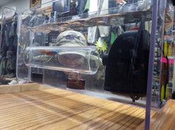 https://thefirstcast.ca/wp-content/uploads/2013/12/Swim_Tank-e1390062882661.jpg
120
160
admin
https://thefirstcast.ca/wp-content/uploads/2013/12/TFC-Header_Web_2B.jpg
admin2017-02-05 23:33:072017-02-06 00:30:17HLS / TFC Swim Tank – Fly Tester
https://thefirstcast.ca/wp-content/uploads/2013/12/Swim_Tank-e1390062882661.jpg
120
160
admin
https://thefirstcast.ca/wp-content/uploads/2013/12/TFC-Header_Web_2B.jpg
admin2017-02-05 23:33:072017-02-06 00:30:17HLS / TFC Swim Tank – Fly Tester https://thefirstcast.ca/wp-content/uploads/2014/02/Accidental-Broken-Sage-Fly-Rod-e1397185075604.jpg
120
120
Ray
https://thefirstcast.ca/wp-content/uploads/2013/12/TFC-Header_Web_2B.jpg
Ray2014-02-13 22:56:372017-02-20 16:58:08Broken or Damaged Fishing Rod Repairs
https://thefirstcast.ca/wp-content/uploads/2014/02/Accidental-Broken-Sage-Fly-Rod-e1397185075604.jpg
120
120
Ray
https://thefirstcast.ca/wp-content/uploads/2013/12/TFC-Header_Web_2B.jpg
Ray2014-02-13 22:56:372017-02-20 16:58:08Broken or Damaged Fishing Rod Repairs https://thefirstcast.ca/wp-content/uploads/2016/10/Custom-Rod-Building-HLS-Mike-Rumig-02132016-AA.jpg
1458
1387
admin
https://thefirstcast.ca/wp-content/uploads/2013/12/TFC-Header_Web_2B.jpg
admin2016-11-02 21:30:392022-11-29 16:09:24Fishing Rod Building Classes
https://thefirstcast.ca/wp-content/uploads/2016/10/Custom-Rod-Building-HLS-Mike-Rumig-02132016-AA.jpg
1458
1387
admin
https://thefirstcast.ca/wp-content/uploads/2013/12/TFC-Header_Web_2B.jpg
admin2016-11-02 21:30:392022-11-29 16:09:24Fishing Rod Building Classes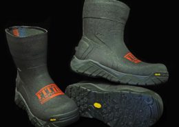 https://thefirstcast.ca/wp-content/uploads/2017/09/2017-Simms-Vibram-Boot-Fit-Kit-AA.jpg
2007
2450
admin
https://thefirstcast.ca/wp-content/uploads/2013/12/TFC-Header_Web_2B.jpg
admin2017-09-02 23:30:062018-12-02 00:48:26Simms Vibram Boot Fit Kit
https://thefirstcast.ca/wp-content/uploads/2017/09/2017-Simms-Vibram-Boot-Fit-Kit-AA.jpg
2007
2450
admin
https://thefirstcast.ca/wp-content/uploads/2013/12/TFC-Header_Web_2B.jpg
admin2017-09-02 23:30:062018-12-02 00:48:26Simms Vibram Boot Fit Kit https://thefirstcast.ca/wp-content/uploads/2014/10/Custom-Rod-Tubes-C-Resized-B1.jpg
3259
2123
Ray
https://thefirstcast.ca/wp-content/uploads/2013/12/TFC-Header_Web_2B.jpg
Ray2014-10-24 11:46:132022-01-04 23:20:32Custom or Factory Fly Rod Tubes – Singles or Doubles
https://thefirstcast.ca/wp-content/uploads/2014/10/Custom-Rod-Tubes-C-Resized-B1.jpg
3259
2123
Ray
https://thefirstcast.ca/wp-content/uploads/2013/12/TFC-Header_Web_2B.jpg
Ray2014-10-24 11:46:132022-01-04 23:20:32Custom or Factory Fly Rod Tubes – Singles or Doubles https://thefirstcast.ca/wp-content/uploads/2014/01/Dave_Gonder_Custom_Spey_Sage_TCX_Deathstar-e1390608597346.jpg
120
113
admin
https://thefirstcast.ca/wp-content/uploads/2013/12/TFC-Header_Web_2B.jpg
admin2014-01-08 11:51:302017-02-20 17:05:55Rod Building and Custom Rod Parts
https://thefirstcast.ca/wp-content/uploads/2014/01/Dave_Gonder_Custom_Spey_Sage_TCX_Deathstar-e1390608597346.jpg
120
113
admin
https://thefirstcast.ca/wp-content/uploads/2013/12/TFC-Header_Web_2B.jpg
admin2014-01-08 11:51:302017-02-20 17:05:55Rod Building and Custom Rod Parts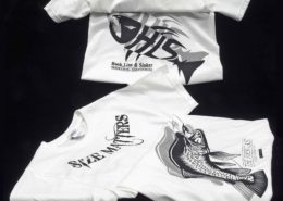 https://thefirstcast.ca/wp-content/uploads/2014/04/HLS-and-TFC-T-Shirts-AA.jpg
2198
1946
Ray
https://thefirstcast.ca/wp-content/uploads/2013/12/TFC-Header_Web_2B.jpg
Ray2014-04-04 13:09:542017-02-20 17:58:36Custom T-Shirts, Caps & More…
https://thefirstcast.ca/wp-content/uploads/2014/04/HLS-and-TFC-T-Shirts-AA.jpg
2198
1946
Ray
https://thefirstcast.ca/wp-content/uploads/2013/12/TFC-Header_Web_2B.jpg
Ray2014-04-04 13:09:542017-02-20 17:58:36Custom T-Shirts, Caps & More… https://thefirstcast.ca/wp-content/uploads/2013/12/line_welder-e1390188044845.jpg
120
160
admin
https://thefirstcast.ca/wp-content/uploads/2013/12/TFC-Header_Web_2B.jpg
admin2013-12-30 23:35:552022-03-18 22:36:08Airflo Fly Line Welding / Repair Machine – SERVICE DISCONTINUED.
https://thefirstcast.ca/wp-content/uploads/2013/12/line_welder-e1390188044845.jpg
120
160
admin
https://thefirstcast.ca/wp-content/uploads/2013/12/TFC-Header_Web_2B.jpg
admin2013-12-30 23:35:552022-03-18 22:36:08Airflo Fly Line Welding / Repair Machine – SERVICE DISCONTINUED. https://thefirstcast.ca/wp-content/uploads/2014/01/Spey-Head-Loaner-Program-Airflo-AA.jpg
1528
2198
admin
https://thefirstcast.ca/wp-content/uploads/2013/12/TFC-Header_Web_2B.jpg
admin2014-01-08 11:35:152017-02-20 18:11:30Spey Head Loaner Program (Airflo / RIO / OPST / Scientific Anglers)
https://thefirstcast.ca/wp-content/uploads/2014/01/Spey-Head-Loaner-Program-Airflo-AA.jpg
1528
2198
admin
https://thefirstcast.ca/wp-content/uploads/2013/12/TFC-Header_Web_2B.jpg
admin2014-01-08 11:35:152017-02-20 18:11:30Spey Head Loaner Program (Airflo / RIO / OPST / Scientific Anglers)We are the leading provider of Fly Fishing Lessons, Corporate Team Building, and Guiding Services on the Upper Grand River, the Upper Credit River, and the Conestogo River.
No Guelph, Fergus, Kitchener or Cambridge Fishing Tackle Retailer will boast as complete and diverse a store inventory, including a vast selection of Fly Fishing Rods, Fly Fishing Reels, Fishing Waders, Wading Boots and Streamside Accessories.
Order a HLS or TFC Gift Card – We will put one in the mail for FREE!
Clearance Sale Fly Shop Flyshop Flyfish Grand River Fly fish Grand River Guide Grand River Lesson Grand River Fergus Ontario Canada