To plan your itinerary and to ensure a pleasant day on the water, treat yourself to incredibly useful navigation tools – digital or printed charts and chartbooks for boaters and anglers. Navigate in full confidence with TrakMaps.
Please see the TrakMaps website here and then contact us for current inventory.
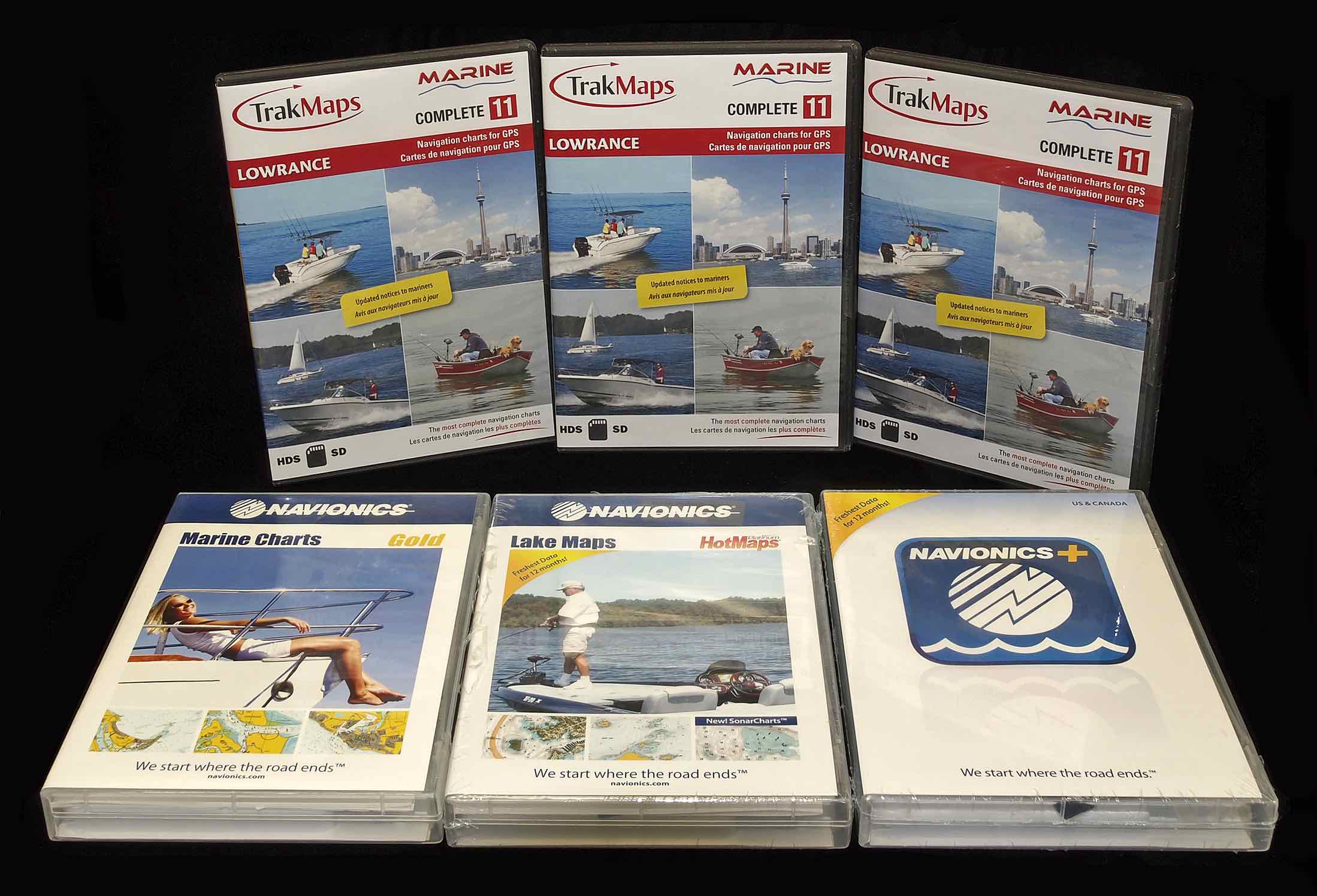
About TrakMaps:
TrakMaps is comprised of an experienced team that has been guiding you since 1999. At the cutting edge of technology, we think outside the box in order to bring our customers the most innovative cartographic products for their outdoor recreation pursuits. As a result, our maps, charts and chartbooks are the first choice for outdoor enthusiasts of all types.
Our data comes from government sources, ATV and snowmobile federations as well as our own bathymetric surveys. Our charts and maps are reliable, accurate and constantly reviewed for accuracy. In collaboration with experienced partners, we create charts and maps tailored to your needs, with your security as a priority.
OUR MISSION: to be your co-pilot of choice for your favourite outdoor activities
OUR VALUES: reliability, precision, quality, integrity and a sense of adventure!
Much like our clients, we too are outdoor enthusiasts and nothing stops us when we are well prepared!
A DYNAMIC & MODERN COMPANY:
SINCE 1999, TRAKMAPS HAS FOLLOWED THE TREND providing thousands of outdoor enthusiasts with maps, charts and chartbooks. Our team, comprised of passionate experts, works tirelessly to maintain the high quality that has made the reputation of the company in the market for digital and printed maps and charts: topographic maps, charts of lakes, rivers and waterways, cycling trails and ATV and snowmobile trails.
Well established in Canada and the United States, the company understands the respective needs of its clients. This is why its priority is to provide maps and charts for the outdoors of the highest quality.
A natural evolution: from printed to digital.
The technology of digital charts and maps for GPS at the service of outdoor enthusiasts, anglers, boaters and adventurers of all kinds.
With the advances of technology, it’s no wonder that more and more outdoor enthusiasts rely on digital maps to plan routes and discover new horizons. Simple and easy to use, digital maps can store a wealth of information and require very little space.
Reliable and pleasant to use, TrakMaps digital maps and charts are developed using government and other data, reviewed and approved.
5 Boating Safety Kits
1. Wear a Lifejacket
A Canadian Red Cross study examining boating deaths across Canada over 20 years found that 1 in 2 deaths could have been prevented if the victims were wearing life jackets.
Even if you are a good swimmer, nothing can prepare you for the rough and cold water, the dark, and you may need to help fellow passengers in distress. The cold shock on hitting the water tends to make you gasp for air, in which case water may enter the lungs. Always wear a lifejacket.
2. Leave the Alcohol Onshore
It shouldn’t be a surprise that alcohol diminishes judgment and reduces motor skills. According to the Canadian Red Cross, alcohol is present or suspected in more than 50% of boating fatalities. Alcohol and boating do not mix. Leave the alcohol onshore and boat sober. Make sure to have non-alcoholic beverages onboard to keep yourselves hydrated.
3. Check the Forecast
Weather services like The Weather Network Marine Forecast can help you plan how you will carry out your day, with useful information like winds, wave periods and wave heights. Always know what is in the forecast to ensure you aren’t stuck boating in poor or dangerous conditions.
4. Double-check Your Equipment
Always ensure you’ve packed the following essentials before leaving shore:
- Lifejackets (with appropriate sizing for those onboard);
- Buoyant heaving line;
- Bell or whistle;
- Visual distress signals or waterproof flashlight;
- Fire extinguisher;
- Drinking water.
These items are indispensable and could very save your life should an incident occur on the water. Check with your local authorities before leaving shore to ensure you are complying with minimum requirements.
5. Get a Nautical Chart
No boating activity is complete without knowing where you are on the water. Make sure to be equipped with a current printed or GPS nautical chart of the area to identify water depths, buoys, hazards, rocks and marinas.
In certain jurisdictions, having official charts, such as CHS charts in Canada and NOAA charts in the United States, are required when navigating on waterways. Check with your local authorities before leaving shore to ensure you are compliant.
 https://thefirstcast.ca/wp-content/uploads/2023/03/IMG_0479-scaled.jpg
1749
2560
Managed WordPress Migration User
https://thefirstcast.ca/wp-content/uploads/2013/12/TFC-Header_Web_2B.jpg
Managed WordPress Migration User2023-03-20 12:41:372023-04-04 21:33:38Retirement Announcement
https://thefirstcast.ca/wp-content/uploads/2023/03/IMG_0479-scaled.jpg
1749
2560
Managed WordPress Migration User
https://thefirstcast.ca/wp-content/uploads/2013/12/TFC-Header_Web_2B.jpg
Managed WordPress Migration User2023-03-20 12:41:372023-04-04 21:33:38Retirement Announcement https://thefirstcast.ca/wp-content/uploads/2022/10/Limited-Edition-Renzetti-Traveler-Vise-Red-and-Blue-B.jpg
1024
1024
admin
https://thefirstcast.ca/wp-content/uploads/2013/12/TFC-Header_Web_2B.jpg
admin2022-10-12 15:18:052022-10-12 15:18:05Limited Edition Renzetti Traveler Vise – Red & Blue
https://thefirstcast.ca/wp-content/uploads/2022/10/Limited-Edition-Renzetti-Traveler-Vise-Red-and-Blue-B.jpg
1024
1024
admin
https://thefirstcast.ca/wp-content/uploads/2013/12/TFC-Header_Web_2B.jpg
admin2022-10-12 15:18:052022-10-12 15:18:05Limited Edition Renzetti Traveler Vise – Red & Blue https://thefirstcast.ca/wp-content/uploads/2022/10/Trabucco-T-Force-Ultra-Strong-FC403.jpeg
392
800
admin
https://thefirstcast.ca/wp-content/uploads/2013/12/TFC-Header_Web_2B.jpg
admin2022-10-06 17:21:202022-10-06 17:28:38Trabucco T Force Ultra Strong FC403 Fluorocarbon Tippet
https://thefirstcast.ca/wp-content/uploads/2022/10/Trabucco-T-Force-Ultra-Strong-FC403.jpeg
392
800
admin
https://thefirstcast.ca/wp-content/uploads/2013/12/TFC-Header_Web_2B.jpg
admin2022-10-06 17:21:202022-10-06 17:28:38Trabucco T Force Ultra Strong FC403 Fluorocarbon Tippet https://thefirstcast.ca/wp-content/uploads/2022/10/Dr.-Slick-Split-Shot-Clamp.jpeg
498
650
admin
https://thefirstcast.ca/wp-content/uploads/2013/12/TFC-Header_Web_2B.jpg
admin2022-10-06 17:11:122022-10-06 17:11:12Dr. Slick Split Shot Clamp
https://thefirstcast.ca/wp-content/uploads/2022/10/Dr.-Slick-Split-Shot-Clamp.jpeg
498
650
admin
https://thefirstcast.ca/wp-content/uploads/2013/12/TFC-Header_Web_2B.jpg
admin2022-10-06 17:11:122022-10-06 17:11:12Dr. Slick Split Shot Clamp https://thefirstcast.ca/wp-content/uploads/2022/10/Dr-slick-slickrelease-clamp.jpeg
317
159
admin
https://thefirstcast.ca/wp-content/uploads/2013/12/TFC-Header_Web_2B.jpg
admin2022-10-06 17:01:382022-10-06 17:36:18Dr. Slick SlickRelease Clamp
https://thefirstcast.ca/wp-content/uploads/2022/10/Dr-slick-slickrelease-clamp.jpeg
317
159
admin
https://thefirstcast.ca/wp-content/uploads/2013/12/TFC-Header_Web_2B.jpg
admin2022-10-06 17:01:382022-10-06 17:36:18Dr. Slick SlickRelease Clamp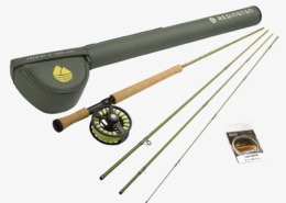 https://thefirstcast.ca/wp-content/uploads/2022/05/Redington-Trout-Spey-Field-Kit-scaled.jpeg
2560
2560
admin
https://thefirstcast.ca/wp-content/uploads/2013/12/TFC-Header_Web_2B.jpg
admin2022-05-08 22:52:592022-05-08 23:15:15Redington Trout Spey Field Kit
https://thefirstcast.ca/wp-content/uploads/2022/05/Redington-Trout-Spey-Field-Kit-scaled.jpeg
2560
2560
admin
https://thefirstcast.ca/wp-content/uploads/2013/12/TFC-Header_Web_2B.jpg
admin2022-05-08 22:52:592022-05-08 23:15:15Redington Trout Spey Field Kit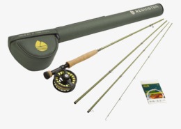 https://thefirstcast.ca/wp-content/uploads/2022/05/Redington-Euro-Nymph-Kit-3100-4-scaled.jpeg
2560
2560
admin
https://thefirstcast.ca/wp-content/uploads/2013/12/TFC-Header_Web_2B.jpg
admin2022-05-08 22:33:242022-05-08 23:14:44The Redington Euro Nymph Field Kit
https://thefirstcast.ca/wp-content/uploads/2022/05/Redington-Euro-Nymph-Kit-3100-4-scaled.jpeg
2560
2560
admin
https://thefirstcast.ca/wp-content/uploads/2013/12/TFC-Header_Web_2B.jpg
admin2022-05-08 22:33:242022-05-08 23:14:44The Redington Euro Nymph Field Kit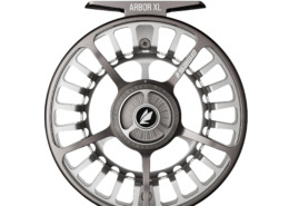 https://thefirstcast.ca/wp-content/uploads/2022/04/Sage-Arbor-XL-Fly-Reel.jpg
2036
2048
admin
https://thefirstcast.ca/wp-content/uploads/2013/12/TFC-Header_Web_2B.jpg
admin2022-04-11 18:26:192022-04-11 18:31:31Sage Arbor XL Fly Reel
https://thefirstcast.ca/wp-content/uploads/2022/04/Sage-Arbor-XL-Fly-Reel.jpg
2036
2048
admin
https://thefirstcast.ca/wp-content/uploads/2013/12/TFC-Header_Web_2B.jpg
admin2022-04-11 18:26:192022-04-11 18:31:31Sage Arbor XL Fly Reel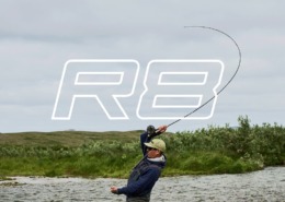 https://thefirstcast.ca/wp-content/uploads/2022/03/Sage-R8-Core-Fly-Rod.jpeg
720
1280
admin
https://thefirstcast.ca/wp-content/uploads/2013/12/TFC-Header_Web_2B.jpg
admin2022-03-26 18:06:362022-04-11 17:29:12Sage R8 Core Single Hand Fly Rods
https://thefirstcast.ca/wp-content/uploads/2022/03/Sage-R8-Core-Fly-Rod.jpeg
720
1280
admin
https://thefirstcast.ca/wp-content/uploads/2013/12/TFC-Header_Web_2B.jpg
admin2022-03-26 18:06:362022-04-11 17:29:12Sage R8 Core Single Hand Fly Rods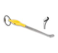 https://thefirstcast.ca/wp-content/uploads/2022/01/Loon-Ergo-Quick-Release-Ultimate-Hook-Removal-Tool.jpeg
248
203
admin
https://thefirstcast.ca/wp-content/uploads/2013/12/TFC-Header_Web_2B.jpg
admin2022-01-27 22:05:522022-01-27 22:05:52The Loon Ergo Quick Release – The Ultimate Hook Removal Tool
https://thefirstcast.ca/wp-content/uploads/2022/01/Loon-Ergo-Quick-Release-Ultimate-Hook-Removal-Tool.jpeg
248
203
admin
https://thefirstcast.ca/wp-content/uploads/2013/12/TFC-Header_Web_2B.jpg
admin2022-01-27 22:05:522022-01-27 22:05:52The Loon Ergo Quick Release – The Ultimate Hook Removal Tool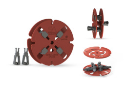 https://thefirstcast.ca/wp-content/uploads/2022/01/Scientific-Anglers-Regulator-Spool-Portable-Fly-Line-Winder.jpeg
900
900
admin
https://thefirstcast.ca/wp-content/uploads/2013/12/TFC-Header_Web_2B.jpg
admin2022-01-18 16:58:432022-01-18 16:58:43Scientific Anglers Regulator Spool – Portable Fly Line Winder
https://thefirstcast.ca/wp-content/uploads/2022/01/Scientific-Anglers-Regulator-Spool-Portable-Fly-Line-Winder.jpeg
900
900
admin
https://thefirstcast.ca/wp-content/uploads/2013/12/TFC-Header_Web_2B.jpg
admin2022-01-18 16:58:432022-01-18 16:58:43Scientific Anglers Regulator Spool – Portable Fly Line Winder https://thefirstcast.ca/wp-content/uploads/2020/12/Islander-Gold-2-5-Inch-Magnetic-Stainless-Bottle-Opener.png
452
916
admin
https://thefirstcast.ca/wp-content/uploads/2013/12/TFC-Header_Web_2B.jpg
admin2020-12-09 21:20:172020-12-09 21:20:17Islander Gold 2.5″ Magnetic Stainless Bottle Opener
https://thefirstcast.ca/wp-content/uploads/2020/12/Islander-Gold-2-5-Inch-Magnetic-Stainless-Bottle-Opener.png
452
916
admin
https://thefirstcast.ca/wp-content/uploads/2013/12/TFC-Header_Web_2B.jpg
admin2020-12-09 21:20:172020-12-09 21:20:17Islander Gold 2.5″ Magnetic Stainless Bottle Opener https://thefirstcast.ca/wp-content/uploads/2019/11/Loon-Vise-Pawn_greybackground_NEW_1024x1024_1dbd39a5-bd43-4401-9247-fcd8dbdb7994_1200x.jpg
1024
1024
admin
https://thefirstcast.ca/wp-content/uploads/2013/12/TFC-Header_Web_2B.jpg
admin2019-11-18 19:32:582020-03-29 21:11:08Loon Vise Pawn
https://thefirstcast.ca/wp-content/uploads/2019/11/Loon-Vise-Pawn_greybackground_NEW_1024x1024_1dbd39a5-bd43-4401-9247-fcd8dbdb7994_1200x.jpg
1024
1024
admin
https://thefirstcast.ca/wp-content/uploads/2013/12/TFC-Header_Web_2B.jpg
admin2019-11-18 19:32:582020-03-29 21:11:08Loon Vise Pawn https://thefirstcast.ca/wp-content/uploads/2016/08/Polar-Bear-for-Fly-Tying-AA.jpg
1049
2198
admin
https://thefirstcast.ca/wp-content/uploads/2013/12/TFC-Header_Web_2B.jpg
admin2016-08-14 19:01:512018-12-02 00:50:03Polar Bear Fur / Bodyskin – Fly Tying Material
https://thefirstcast.ca/wp-content/uploads/2016/08/Polar-Bear-for-Fly-Tying-AA.jpg
1049
2198
admin
https://thefirstcast.ca/wp-content/uploads/2013/12/TFC-Header_Web_2B.jpg
admin2016-08-14 19:01:512018-12-02 00:50:03Polar Bear Fur / Bodyskin – Fly Tying Material https://thefirstcast.ca/wp-content/uploads/2014/01/Mesh-Tailing-Gloves-Resized-for-Web.jpg
2205
3189
Ray
https://thefirstcast.ca/wp-content/uploads/2013/12/TFC-Header_Web_2B.jpg
Ray2014-01-16 04:01:272017-01-19 19:36:21Mesh Tailing Gloves
https://thefirstcast.ca/wp-content/uploads/2014/01/Mesh-Tailing-Gloves-Resized-for-Web.jpg
2205
3189
Ray
https://thefirstcast.ca/wp-content/uploads/2013/12/TFC-Header_Web_2B.jpg
Ray2014-01-16 04:01:272017-01-19 19:36:21Mesh Tailing Gloves https://thefirstcast.ca/wp-content/uploads/2014/01/TFC-Grade-B-Jungle-Cock-BB.jpg
2448
3264
admin
https://thefirstcast.ca/wp-content/uploads/2013/12/TFC-Header_Web_2B.jpg
admin2015-08-27 21:52:292017-01-15 17:48:17Jungle Cock Fly Tying Feathers
https://thefirstcast.ca/wp-content/uploads/2014/01/TFC-Grade-B-Jungle-Cock-BB.jpg
2448
3264
admin
https://thefirstcast.ca/wp-content/uploads/2013/12/TFC-Header_Web_2B.jpg
admin2015-08-27 21:52:292017-01-15 17:48:17Jungle Cock Fly Tying Feathers https://thefirstcast.ca/wp-content/uploads/2015/10/TFC-Intruder-Tubes-AA.jpg
2046
2198
admin
https://thefirstcast.ca/wp-content/uploads/2013/12/TFC-Header_Web_2B.jpg
admin2015-10-30 18:11:112017-02-26 20:20:40TFC Clear Intruder Tubes
https://thefirstcast.ca/wp-content/uploads/2015/10/TFC-Intruder-Tubes-AA.jpg
2046
2198
admin
https://thefirstcast.ca/wp-content/uploads/2013/12/TFC-Header_Web_2B.jpg
admin2015-10-30 18:11:112017-02-26 20:20:40TFC Clear Intruder Tubes https://thefirstcast.ca/wp-content/uploads/2014/03/Online-Sales-Image.jpg
166
303
Ray
https://thefirstcast.ca/wp-content/uploads/2013/12/TFC-Header_Web_2B.jpg
Ray2014-03-02 13:45:372019-04-01 19:32:53Online Sales
https://thefirstcast.ca/wp-content/uploads/2014/03/Online-Sales-Image.jpg
166
303
Ray
https://thefirstcast.ca/wp-content/uploads/2013/12/TFC-Header_Web_2B.jpg
Ray2014-03-02 13:45:372019-04-01 19:32:53Online Sales https://thefirstcast.ca/wp-content/uploads/2014/02/Sale-Button-e1392429154585.jpg
120
120
Ray
https://thefirstcast.ca/wp-content/uploads/2013/12/TFC-Header_Web_2B.jpg
Ray2014-03-02 22:21:232017-02-12 18:25:20Clearance and Sale Items
https://thefirstcast.ca/wp-content/uploads/2014/02/Sale-Button-e1392429154585.jpg
120
120
Ray
https://thefirstcast.ca/wp-content/uploads/2013/12/TFC-Header_Web_2B.jpg
Ray2014-03-02 22:21:232017-02-12 18:25:20Clearance and Sale Items https://thefirstcast.ca/wp-content/uploads/2014/02/Gift-Card-Button-Brown-Trou-Head-e1392437742341.jpg
120
187
Ray
https://thefirstcast.ca/wp-content/uploads/2013/12/TFC-Header_Web_2B.jpg
Ray2014-02-14 23:20:332017-02-20 16:45:47Gift Cards are available in ANY Denomination
https://thefirstcast.ca/wp-content/uploads/2014/02/Gift-Card-Button-Brown-Trou-Head-e1392437742341.jpg
120
187
Ray
https://thefirstcast.ca/wp-content/uploads/2013/12/TFC-Header_Web_2B.jpg
Ray2014-02-14 23:20:332017-02-20 16:45:47Gift Cards are available in ANY Denomination https://thefirstcast.ca/wp-content/uploads/2014/02/Joe-Penich-Altantic-Salmon-Wetfly-Session-030114-Resized-for-Web-e1393785098533.jpg
120
160
Ray
https://thefirstcast.ca/wp-content/uploads/2013/12/TFC-Header_Web_2B.jpg
Ray2014-02-17 19:43:022017-01-04 12:44:10Weekly Guest Tyer and Presenter Events – Sat. Noon to 3.
https://thefirstcast.ca/wp-content/uploads/2014/02/Joe-Penich-Altantic-Salmon-Wetfly-Session-030114-Resized-for-Web-e1393785098533.jpg
120
160
Ray
https://thefirstcast.ca/wp-content/uploads/2013/12/TFC-Header_Web_2B.jpg
Ray2014-02-17 19:43:022017-01-04 12:44:10Weekly Guest Tyer and Presenter Events – Sat. Noon to 3.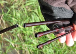 https://thefirstcast.ca/wp-content/uploads/2014/01/Broken-St-e1392174268976.jpg
120
120
Ray
https://thefirstcast.ca/wp-content/uploads/2013/12/TFC-Header_Web_2B.jpg
Ray2014-02-11 22:02:342019-02-09 22:42:23Warranty Repairs & Service
https://thefirstcast.ca/wp-content/uploads/2014/01/Broken-St-e1392174268976.jpg
120
120
Ray
https://thefirstcast.ca/wp-content/uploads/2013/12/TFC-Header_Web_2B.jpg
Ray2014-02-11 22:02:342019-02-09 22:42:23Warranty Repairs & Service https://thefirstcast.ca/wp-content/uploads/2014/07/Wedding-Boutonniere-Bombanieri-Resized-e1404351818683.jpg
89
120
Ray
https://thefirstcast.ca/wp-content/uploads/2013/12/TFC-Header_Web_2B.jpg
Ray2014-07-02 21:25:062020-08-01 20:51:05Wedding Boutonnieres
https://thefirstcast.ca/wp-content/uploads/2014/07/Wedding-Boutonniere-Bombanieri-Resized-e1404351818683.jpg
89
120
Ray
https://thefirstcast.ca/wp-content/uploads/2013/12/TFC-Header_Web_2B.jpg
Ray2014-07-02 21:25:062020-08-01 20:51:05Wedding Boutonnieres https://thefirstcast.ca/wp-content/uploads/2013/12/hardy_seat-e1390187906796.jpg
120
160
admin
https://thefirstcast.ca/wp-content/uploads/2013/12/TFC-Header_Web_2B.jpg
admin2013-12-30 23:59:212022-11-29 15:53:34Fly Reel Repairs and Customization – Have a Fly Reel sitting idle due to a river mishap?
https://thefirstcast.ca/wp-content/uploads/2013/12/hardy_seat-e1390187906796.jpg
120
160
admin
https://thefirstcast.ca/wp-content/uploads/2013/12/TFC-Header_Web_2B.jpg
admin2013-12-30 23:59:212022-11-29 15:53:34Fly Reel Repairs and Customization – Have a Fly Reel sitting idle due to a river mishap?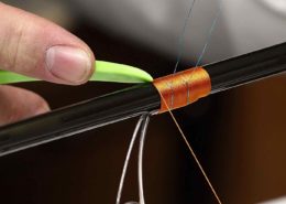 https://thefirstcast.ca/wp-content/uploads/2017/02/Custom-Rod-Building-HLS-Mike-Rumig-02132016-AA.jpg
1458
1387
admin
https://thefirstcast.ca/wp-content/uploads/2013/12/TFC-Header_Web_2B.jpg
admin2017-02-12 18:14:222017-02-12 18:14:22Custom Rod Building
https://thefirstcast.ca/wp-content/uploads/2017/02/Custom-Rod-Building-HLS-Mike-Rumig-02132016-AA.jpg
1458
1387
admin
https://thefirstcast.ca/wp-content/uploads/2013/12/TFC-Header_Web_2B.jpg
admin2017-02-12 18:14:222017-02-12 18:14:22Custom Rod Building https://thefirstcast.ca/wp-content/uploads/2017/03/Simms-customshop.png
506
1000
admin
https://thefirstcast.ca/wp-content/uploads/2013/12/TFC-Header_Web_2B.jpg
admin2017-03-12 18:13:052019-04-24 19:16:16Simms Custom Breathable Wader Options
https://thefirstcast.ca/wp-content/uploads/2017/03/Simms-customshop.png
506
1000
admin
https://thefirstcast.ca/wp-content/uploads/2013/12/TFC-Header_Web_2B.jpg
admin2017-03-12 18:13:052019-04-24 19:16:16Simms Custom Breathable Wader Options https://thefirstcast.ca/wp-content/uploads/2014/01/Custom-Built-Bamboo-Rods-e1389654009722.png
120
239
admin
https://thefirstcast.ca/wp-content/uploads/2013/12/TFC-Header_Web_2B.jpg
admin2018-08-06 21:58:362020-04-28 21:24:35Split Cane or Bamboo Fishing Rod Repairs
https://thefirstcast.ca/wp-content/uploads/2014/01/Custom-Built-Bamboo-Rods-e1389654009722.png
120
239
admin
https://thefirstcast.ca/wp-content/uploads/2013/12/TFC-Header_Web_2B.jpg
admin2018-08-06 21:58:362020-04-28 21:24:35Split Cane or Bamboo Fishing Rod Repairs https://thefirstcast.ca/wp-content/uploads/2014/03/Berkley-Cyclone-Line-Winder-Edit-e1393793846894.jpg
120
161
Ray
https://thefirstcast.ca/wp-content/uploads/2013/12/TFC-Header_Web_2B.jpg
Ray2014-03-02 15:59:012017-02-20 16:54:14Professional Spooling / Winding – Fly Line & Backing / Dacron
https://thefirstcast.ca/wp-content/uploads/2014/03/Berkley-Cyclone-Line-Winder-Edit-e1393793846894.jpg
120
161
Ray
https://thefirstcast.ca/wp-content/uploads/2013/12/TFC-Header_Web_2B.jpg
Ray2014-03-02 15:59:012017-02-20 16:54:14Professional Spooling / Winding – Fly Line & Backing / Dacron https://thefirstcast.ca/wp-content/uploads/2017/02/1930s-Pre-War-JW-Young-and-Sons-Model-10B-4-inch-A-and-N-Stores-Ltd-Victoria-St-London-SW-The-Ebury-Rivet-Bottom-SSS.jpg
2331
3780
admin
https://thefirstcast.ca/wp-content/uploads/2013/12/TFC-Header_Web_2B.jpg
admin2017-02-06 17:57:572020-01-18 13:06:26Vintage Hardy Reel Repairs
https://thefirstcast.ca/wp-content/uploads/2017/02/1930s-Pre-War-JW-Young-and-Sons-Model-10B-4-inch-A-and-N-Stores-Ltd-Victoria-St-London-SW-The-Ebury-Rivet-Bottom-SSS.jpg
2331
3780
admin
https://thefirstcast.ca/wp-content/uploads/2013/12/TFC-Header_Web_2B.jpg
admin2017-02-06 17:57:572020-01-18 13:06:26Vintage Hardy Reel Repairs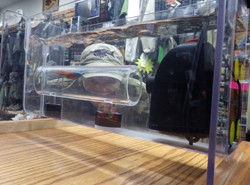 https://thefirstcast.ca/wp-content/uploads/2013/12/Swim_Tank-e1390062882661.jpg
120
160
admin
https://thefirstcast.ca/wp-content/uploads/2013/12/TFC-Header_Web_2B.jpg
admin2017-02-05 23:33:072017-02-06 00:30:17HLS / TFC Swim Tank – Fly Tester
https://thefirstcast.ca/wp-content/uploads/2013/12/Swim_Tank-e1390062882661.jpg
120
160
admin
https://thefirstcast.ca/wp-content/uploads/2013/12/TFC-Header_Web_2B.jpg
admin2017-02-05 23:33:072017-02-06 00:30:17HLS / TFC Swim Tank – Fly Tester https://thefirstcast.ca/wp-content/uploads/2014/02/Accidental-Broken-Sage-Fly-Rod-e1397185075604.jpg
120
120
Ray
https://thefirstcast.ca/wp-content/uploads/2013/12/TFC-Header_Web_2B.jpg
Ray2014-02-13 22:56:372017-02-20 16:58:08Broken or Damaged Fishing Rod Repairs
https://thefirstcast.ca/wp-content/uploads/2014/02/Accidental-Broken-Sage-Fly-Rod-e1397185075604.jpg
120
120
Ray
https://thefirstcast.ca/wp-content/uploads/2013/12/TFC-Header_Web_2B.jpg
Ray2014-02-13 22:56:372017-02-20 16:58:08Broken or Damaged Fishing Rod Repairs https://thefirstcast.ca/wp-content/uploads/2016/10/Custom-Rod-Building-HLS-Mike-Rumig-02132016-AA.jpg
1458
1387
admin
https://thefirstcast.ca/wp-content/uploads/2013/12/TFC-Header_Web_2B.jpg
admin2016-11-02 21:30:392022-11-29 16:09:24Fishing Rod Building Classes
https://thefirstcast.ca/wp-content/uploads/2016/10/Custom-Rod-Building-HLS-Mike-Rumig-02132016-AA.jpg
1458
1387
admin
https://thefirstcast.ca/wp-content/uploads/2013/12/TFC-Header_Web_2B.jpg
admin2016-11-02 21:30:392022-11-29 16:09:24Fishing Rod Building Classes https://thefirstcast.ca/wp-content/uploads/2017/09/2017-Simms-Vibram-Boot-Fit-Kit-AA.jpg
2007
2450
admin
https://thefirstcast.ca/wp-content/uploads/2013/12/TFC-Header_Web_2B.jpg
admin2017-09-02 23:30:062018-12-02 00:48:26Simms Vibram Boot Fit Kit
https://thefirstcast.ca/wp-content/uploads/2017/09/2017-Simms-Vibram-Boot-Fit-Kit-AA.jpg
2007
2450
admin
https://thefirstcast.ca/wp-content/uploads/2013/12/TFC-Header_Web_2B.jpg
admin2017-09-02 23:30:062018-12-02 00:48:26Simms Vibram Boot Fit Kit https://thefirstcast.ca/wp-content/uploads/2014/10/Custom-Rod-Tubes-C-Resized-B1.jpg
3259
2123
Ray
https://thefirstcast.ca/wp-content/uploads/2013/12/TFC-Header_Web_2B.jpg
Ray2014-10-24 11:46:132022-01-04 23:20:32Custom or Factory Fly Rod Tubes – Singles or Doubles
https://thefirstcast.ca/wp-content/uploads/2014/10/Custom-Rod-Tubes-C-Resized-B1.jpg
3259
2123
Ray
https://thefirstcast.ca/wp-content/uploads/2013/12/TFC-Header_Web_2B.jpg
Ray2014-10-24 11:46:132022-01-04 23:20:32Custom or Factory Fly Rod Tubes – Singles or Doubles https://thefirstcast.ca/wp-content/uploads/2014/01/Dave_Gonder_Custom_Spey_Sage_TCX_Deathstar-e1390608597346.jpg
120
113
admin
https://thefirstcast.ca/wp-content/uploads/2013/12/TFC-Header_Web_2B.jpg
admin2014-01-08 11:51:302017-02-20 17:05:55Rod Building and Custom Rod Parts
https://thefirstcast.ca/wp-content/uploads/2014/01/Dave_Gonder_Custom_Spey_Sage_TCX_Deathstar-e1390608597346.jpg
120
113
admin
https://thefirstcast.ca/wp-content/uploads/2013/12/TFC-Header_Web_2B.jpg
admin2014-01-08 11:51:302017-02-20 17:05:55Rod Building and Custom Rod Parts https://thefirstcast.ca/wp-content/uploads/2014/04/HLS-and-TFC-T-Shirts-AA.jpg
2198
1946
Ray
https://thefirstcast.ca/wp-content/uploads/2013/12/TFC-Header_Web_2B.jpg
Ray2014-04-04 13:09:542017-02-20 17:58:36Custom T-Shirts, Caps & More…
https://thefirstcast.ca/wp-content/uploads/2014/04/HLS-and-TFC-T-Shirts-AA.jpg
2198
1946
Ray
https://thefirstcast.ca/wp-content/uploads/2013/12/TFC-Header_Web_2B.jpg
Ray2014-04-04 13:09:542017-02-20 17:58:36Custom T-Shirts, Caps & More… https://thefirstcast.ca/wp-content/uploads/2013/12/line_welder-e1390188044845.jpg
120
160
admin
https://thefirstcast.ca/wp-content/uploads/2013/12/TFC-Header_Web_2B.jpg
admin2013-12-30 23:35:552022-03-18 22:36:08Airflo Fly Line Welding / Repair Machine – SERVICE DISCONTINUED.
https://thefirstcast.ca/wp-content/uploads/2013/12/line_welder-e1390188044845.jpg
120
160
admin
https://thefirstcast.ca/wp-content/uploads/2013/12/TFC-Header_Web_2B.jpg
admin2013-12-30 23:35:552022-03-18 22:36:08Airflo Fly Line Welding / Repair Machine – SERVICE DISCONTINUED. https://thefirstcast.ca/wp-content/uploads/2014/01/Spey-Head-Loaner-Program-Airflo-AA.jpg
1528
2198
admin
https://thefirstcast.ca/wp-content/uploads/2013/12/TFC-Header_Web_2B.jpg
admin2014-01-08 11:35:152017-02-20 18:11:30Spey Head Loaner Program (Airflo / RIO / OPST / Scientific Anglers)
https://thefirstcast.ca/wp-content/uploads/2014/01/Spey-Head-Loaner-Program-Airflo-AA.jpg
1528
2198
admin
https://thefirstcast.ca/wp-content/uploads/2013/12/TFC-Header_Web_2B.jpg
admin2014-01-08 11:35:152017-02-20 18:11:30Spey Head Loaner Program (Airflo / RIO / OPST / Scientific Anglers)We are the leading provider of Fly Fishing Lessons, Corporate Team Building, and Guiding Services on the Upper Grand River, the Upper Credit River, and the Conestogo River.
No Guelph, Fergus, Kitchener or Cambridge Fishing Tackle Retailer will boast as complete and diverse a store inventory, including a vast selection of Fly Fishing Rods, Fly Fishing Reels, Fishing Waders, Wading Boots and Streamside Accessories.
Order a HLS or TFC Gift Card – We will put one in the mail for FREE!